- UCSB Spring Quarter 2013 Geography 232
Cartographic Transformations
Instructor: Keith
C. Clarke
Office:
Phone: 805-456-2827
Email to: kclarke@geog.ucsb.edu
Office Hours: Wednesday 9:00-11:00 am.
Seminar: Class meets Tuesdays
8:00-11:00am TBA 1720 Ellison Hall.
When----------------------
What----------------------
Discussion
April 2nd An overview of map transformations. Goals for
the class.
Moellering's Bibliography
Clarke Chapter 8 . Chapter 9 . Chapter 10
April 9th: No class meeting
A transformational view of cartography
Tobler 1959, Tobler 1979 , Chrisman
April 16th
Analytical cartography
Tobler 1976
,
Clarke & Cloud 2000 , Tobler 2000
April 23rd
Analytical cartography, GIScience,
GeoComputation, GeoVis
What is GeoComputation? A history and outline .
Ehlen et al. (2002)
Kwan
(2000)
Saalfeld (2002)
Atkinson (2001)
Kraak (2002)
Goodchild (1992)
Couclelis (1998)
Cartography Specialty group.
April 30th
Map projections
Tobler website.
Geographers Craft (Dana) Map Projections
(Anderson)
Snyder 1984
Tobler
2004
Steinwand
et al. 1995
Mulcahy+Clarke 2001
Brainerd+Pang 2001
May 7th
Interpolation
Tobler 1979 Lam 1983 Armstrong 2000 Cooper & Jarvis 2004 Demirhan 2003 Goovaerts 2000 Kyriakidis
2004
Schloeder et al 2001 Waldo Tobler's PPT presentation
May 14th |
Terrain surfaces and skeletons
Pike 2002
Mark 1975 Gallant & Wilson 1996
Florinsky 1998 Zhou & Liu 2004 Zhang et al 1999 Corripio 2003
May 24th FRIDAY
Spatial Indexing Methods
Samet 1990
Bentley 1975
Omohudro 1989
Muja+Lowe 2009
Tobler+Chen 1986
Peucker+Chrisman 1975
Goodchild 2000
May 28th Fractals and spatial metrics
Burrough Dutton Herold
et al Neel et al
June 4th
Technological transformations
Nechero
and Vreeland Goodchild
Schuurman
Wright et al.
June 3rd MONDAY Final Paper
Formal Presentations
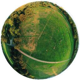
Cartography has been called "A discipline in transformations." The very nature of cartographic representation involves gathering spatial information and then subjecting it to transformations of dimension, scaling, scale, geometry and symbolization before the information is ready for viewing and interpretation.
In this seminar we will explore the transformational view of
cartography using the approach of analytical cartography. Students are expected to read material in advance, and come to class prepared for in-depth discussion of cartographic research. A term paper will be required on a topic of the students choice.
Weekly reading assignments include various papers and book chapters.
These will be circulated in class.
This page last updated 4/1/2013 by Keith Clarke kclarke@geog.ucsb.edu
|