Climate Hazards Center Researchers Tackle Mapping and Forecasting Water Availablity Across Africa
Climate Hazards Center (CHC) Researchers Shraddhanand Shukla and Chris Funk are part of a team working to ease water stress by forecasting and developing early warning alerts for seasonal water availability.
Climate Hazards Center (CHC) Researchers Shrad Shukla and Chris Funk are part of a team working to ease water stress in Sub-Saharan Africa by forecasting and developing early warning alerts for seasonal water availability. This project is one of the 30 chosen from NASA’s recent solicitation for proposals to support the research, development, and deployment of applications using Earth observations for water resources management. This was awarded to a group of researchers led by Dr. Kimberly Slinski of the University of Maryland Earth System Science Interdisciplinary Center and NASA Godard Space Flight Center (GSFC) and includes researchers from the UCSB Climate Hazards Center and several other institutions.
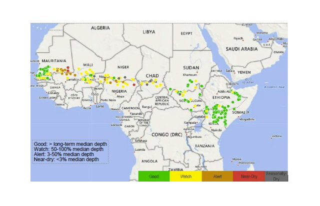
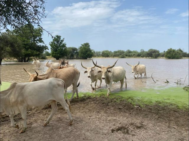
The rangeland monitoring and forecasting system that this project aims to develop will be first-of-its-kind system and will provide monitoring of water level in small water bodies across Sub Saharan Africa, and early warning of water level from weather (2 weeks in advance) to seasonal scale (6 month in advance). The CHC is leading the development and integration of water level forecasts using the weather and climate forecasts developed at CHC with support of past funding from USAID, USGS, NASA, SERVIR. The CHC is also working with stakeholder engagement and capacity building to facilitate integration of this monitoring and forecasting system with the operational climate services in Sub Saharan Africa to maximize the real-world application of this tool for supporting critical decisions. For example, such a system can allow disaster response agencies to better plan for and implement mitigating actions, including ensuring access to alternate water supplies through water trucking or increased maintenance and repair of groundwater pumping stations. Mitigating actions can also include limiting herd size to a number that can be supported by rangeland conditions (de-stocking). These actions are costly to implement, therefore, good data on current and forecasted conditions are essential to the decision makers responsible for implementing drought-response actions.
Read more about the research team and their work at NASA Harvest and ClimateLinks.Org.