Lecture Notes for Clarke, K. C. Analytical and Computer Cartography
Lecture 13: Data Structure Transformations
Transformations
- Map scale
- Dimension (data type)
- Symbolic content (map type)
- Data structures
- So far have covered part of one and all of two and three
Why Transform Between Structures?
- Geocoding stamps coordinate system, resolution and projection onto objects.
- Data usually in generic formats at first
- Can save space, gain flexibility, decrease processing time
- Suit dmands of analysis and modeling
- Suit demands of map symbolization (e.g. fonts)
Generalization Transformations
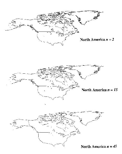
- Conversion of data collected at higher resolutions to lower resolution.
Less data and less detail.
- Simplicity -> clarity
- Can be loss-less or lossy.
Point-to-Point
Consquence of projection. E.g. 3-arc second DEMs.
Line-to-Line
Problem of "line character"
- Algorithmic resampling i.e. reduce # of points in finite sample
- Algorithmic reconstruction
- Enhancement
Algorithms (Reviewed by McMaster)
- N-th Point retention
- Equidistant Resampling
- Douglas-Peucker
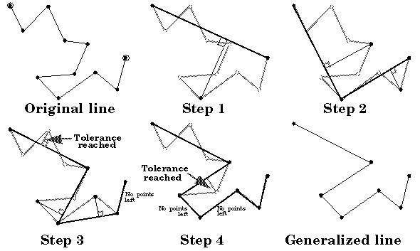
Example (Using Animation) Courtesy of Brad Allen and Waldo Tobler.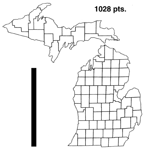
Enhancement
- Splines
- Bezier Curves
- Polynomial Functions
- Trigonometric Functions (Fourier-based)
3. Enhancement
Area-to-Area
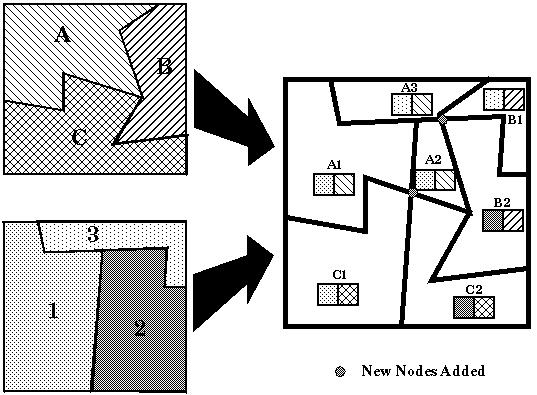
- Problem is given one set of regions, convert to another
- Example: Convert census tract data to zip codes for marketing
- Example: Convert crime data by police precinct to school district
- Greatest common geographic units: Full overlap set for reassignment.
- May require dividing non-divisible measures, e.g population
Algorithms for Overlay
- 1. Intersections
- 2. Chain splitting
- 3. Polygon reassembly
- 4. Labeling and attribution
Volume-to-Volume
- Common conversion between two major data structures, vector (TIN) and grid.
- Often via points and interpolation.
- Problem of VIPs
Vector to Raster and Back Again
- Efficient V->R-> V has eliminated vector-raster debate, BUT is a major source
of error
- major consumer of processing power
Vector to Raster
- Easy compared to inverse, a form of resampling
- Grid must realate to coordinates (extent, bounds, resolution, orientation)
- Rasters can be square, rectangular, hexagonal.
- Resample at minimum r/2
- Both structures may be tiled.
- Problem: What value goes into the cell?
- Separate arrays for dimensions and binary data?
- Index entries & look up tables
Algorithm (e.g. rasterize)
- Convert form of vectors (e.g. to slope intercept)
- Thin fat lines
- Compute implicit inclusion (anti-alias)
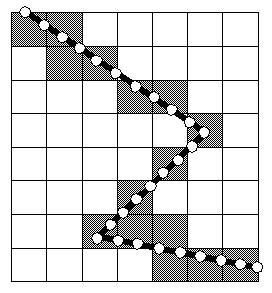
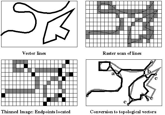
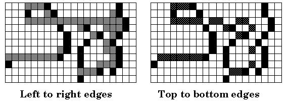
Raster to Vector
- Much harder, more error prone.
- May involve cartographer intervention (e.g. Laserscan)
- Importance of allignment
- Can do points, lines, area.
Algorithms
- Skeletonization and Thinning
- Peeling
- Expanding
- Medial Axis
- Feature Extraction
- Topological Reconstruction
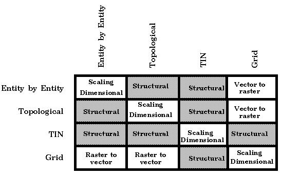
Data Structure Transformations
- Scale transformations are lossy
- (re)storage produce error
- algorithmic error, systematic and random
- Types are: scale, structural (data structure), dimensional, vector-to-raster.
The Role of Error
- Kate Beard: Source error, use error, process error
- Morrison: Method-produced error
- Error is inherent, can it be predicted, controlled or minimized?
- XT = X'
- X' T^-1 = X + E
Errors are
- positional
- attribute
- systematic
- random
- known
- uncertain
- Errors can be attributed to poor choice of transformations
- Incompatible sequences of T's (non-invertible)
- "Hidden" Error=use error, not process error
Keith Clarke Last Change 5/14/97 Copyright Prentice Hall, 1995