LECTURE 14: LOCATION-BASED SERVICES
1. LBS DEFINITIONS
2. WHY IS LOCATION IMPORTANT?
3. SOCIAL ISSUES
4. LOCATION TECHNOLOGIES
5. INFORMATION SERVICES
6. VR AND AR
7. AN LBS RESEARCH AGENDA
What is a location-based service?
an information service provided by a device that knows where it isWhat fits this double test?and modifies the information it provides accordingly
any location-measuring deviceWhat location?any device with GPSany device whose location can be inferredany device that uses knowledge of location to select, transform, modify information
location of the user, of the human-computer interfaceIs a GIS an LBS?location of the subject matter
centered on the user location?location of the data serverlocation of the processing server
typically no, the GIS has no way of knowing where it isAre desktop computers capable of providing LBS?or of modifying its results accordingly
e.g. by centering all map displays on the user's actual locatione.g. by displaying the user's actual location on map displays
no, they typically do not know where they areCan location be inferred from an IP address?only to a timezone perhaps
frequently to countryIP addresses outside the US typically use the country as the major domainthe registration record for an IP address contains a street addresse.g. .uk, .fi, .eebut not always
but it need not be the location of the computer using that IPcrawlers can sometimes determine the locations of Web pagesif they have embedded street addressesthe Internet was designed to abolish distanceFrances Cairncross, The Death of Distance: How the Communications Revolution Will Change Our Lives (Harvard Business School Press, 1997)but location turned out to be important after allThe Revenge of Geography (The Economist, March 15, 2003)"It was naive to imagine that the global reach of the Internet would make geography irrelevant. Wireline and wireless technologies have bound the virtual and physical worlds closer than ever"
Because the user wants to know
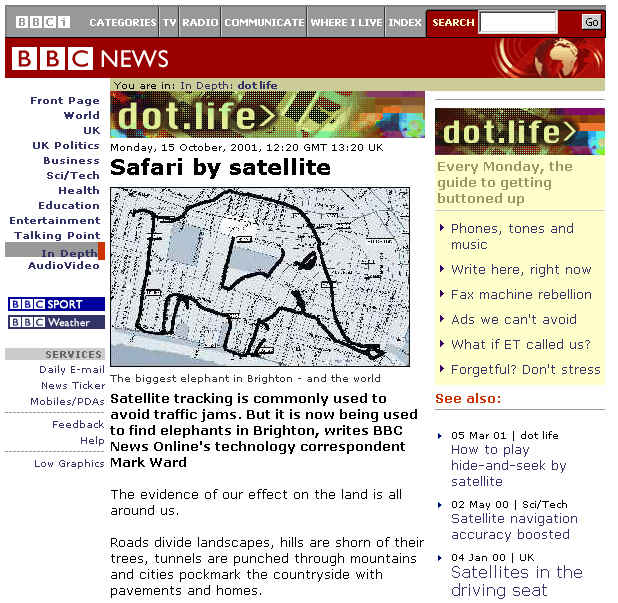
wayfindingBecause someone else wants to knowlocating sample points in the field
in the absence of landmarksnavigating at seahaving fun
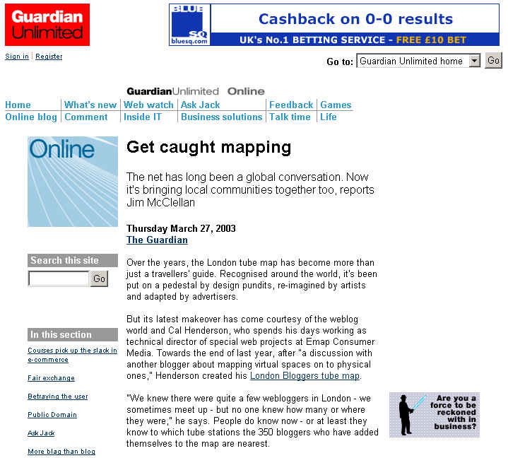
geocaching (http://www.geocaching.com)tracing figures: (http://news.bbc.co.uk/1/hi/in_depth/sci_tech/2000/dot_life/1595670.stm)
latitude-longitude convergences, state boundary nodes
car rental agency: http://news.com.com/2100-1040-268747.html?legacy=cnetsearch engines
tuning search engines to local needsdirected emailgoogle.com redirected to google.fi if hit from a .fi IP addressranking hits by proximity to IP address
a revenue streamemailing to all addresses in a polygondirected telemarketingto all phones in a polygonintelligence agenciesyour residential phone is already geocoded for E911Total Information Awarenesspatterns in space and time can be indicative of certain types of activity
mining for misuse of credit cards
Do we have a right to location privacy?
who has the right to know where we are?US law:do we have a right to sell our location privacy?
in return for store discounts?
E911
calls from cellphonesUK law:sample story: http://www.popsci.com/popsci/science/article/0,12543,266052,00.htmlWireless Communication and Public Safety Act of 1999``(4) to provide call location information concerning the user of a commercial mobile service (as such term is defined in section 332(d))_``(A) to a public safety answering point, emergency medical service provider or emergency dispatch provider, public safety, fire service, or law enforcement official, or hospital emergency or trauma care facility, in order to respond to the user's call for emergency services;
``(B) to inform the user's legal guardian or members of the user's immediate family of the user's location in an emergency situation that involves the risk of death or serious physical harm; or
``(C) to providers of information or database management services solely for purposes of assisting in the delivery of emergency services in response to an emergency.''.
Telecommunications (Data Protection and Privacy) Regulations 1999Is there adequate regulatory protection for the use of location in traffic data?limitations on the processing of traffic and billing data by carriers (no clear reference to location)Regulation of Investigatory Powers Act 2001can require recovery of location known from mobile phones (when this is part of traffic data) for intelligence purposes
who has access to the location?Do users have control over their location information?how long should it be kept for?
what geographic resolution is available?
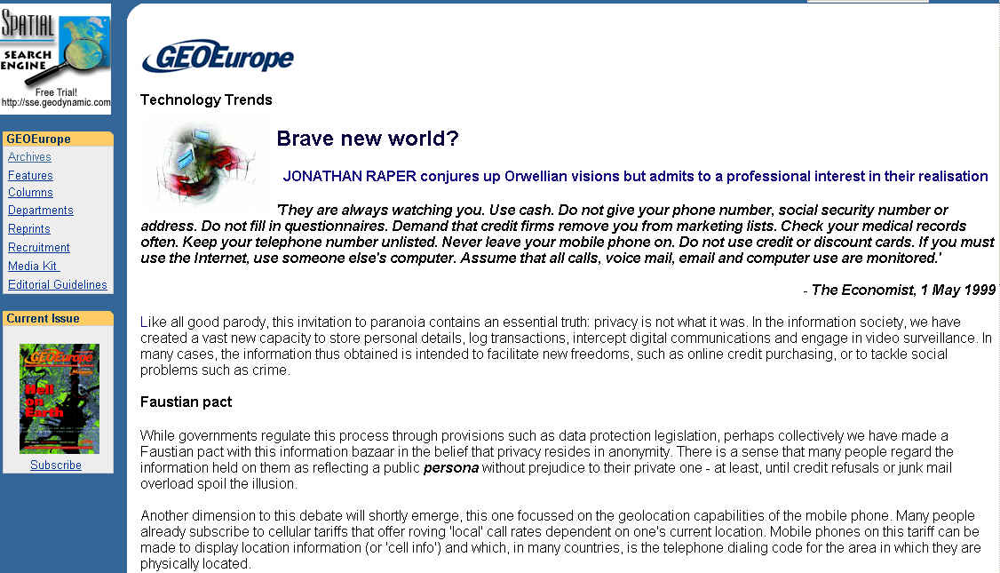
What is privacy?
relates to individuals"They are always watching you. Use cash. Do not give your phone number, social security number or address. Do not fill in questionnaires. Demand that credit firms remove you from marketing lists. Check your medical records often. Keep your telephone number unlisted. Never leave your mobile phone on. Do not use credit or discount cards. If you must use the Internet, use someone elses computer. Assume that all calls, voice mail, email and computer use are monitored."guards against intrusion, appropriation, breach of confidence
Economist 1 May 1999Location privacy
protection of information about your current or home location in space or cyberspacecurrently no explicit regulation of locational privacy
Raper essay in January 2001 GeoEurope http://www.geoplace.com/ge/2001/0101/0101tt.asp
private persona - should be absolutely protected
public persona - tradeable by consent, disconnected from the private persona
How to determine the location of a device (human-computer interface)?
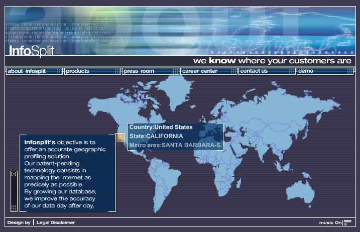
location is entered by the user/system administratorCellphone geolocationat system build timeIP addresspoint-of-sale systemsat application timecredit card transactionscredit card fraud applicationsstore loyalty card transactions
directed advertizing
buying habits
MapQuest userretained by server
the business of geolocationGPSQuova: http://www.quova.com/services/services.htmlDigital Envoy: http://www.digitalenvoy.net/
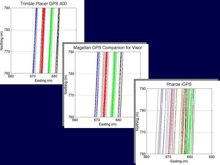
direct measurement of locationbut GPS failsbetter than 10m with PCMCIA card
Suunto wristwatchunder overpassessupplementing GPSindoors
under thick tree canopy
in urban canyons
98% success reported on San Francisco Bay roads20% success in Hong Kong bus tracking
with inertial navigation systemswith differential corrections (DGPS, WAAS)
by 2000 cellphones exceeded home PCs in Italy, Finland, Sweden, Norway, UK, Denmark, Germany, S Korea, Japan, FranceCell identificationUS still only 40% compared with 60% homes with PCsthrough GPS embedded in phonebattery consumption issuesmeasured by service provideror by the device
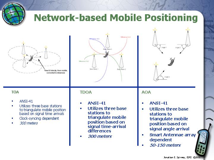
positional accuracy depends on size of cellTriangulation from towerscan locate in one of three 120-degree sectors
by timing signals can locate in concentric bands outwards from tower
positional accuracy perhaps 500mseveral distinct standards
assuming signal can be received by at least three towersMeasurement by deviceseveral standards
location to perhaps 300m
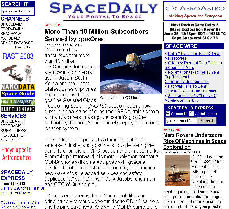
using embedded GPS combined with signals from towersLocations used internally by provider, or passed to external applicationsA-GPSsimilar accuracy with enhanced signal timing E-OTDQualcomm's gpsOne (http://www.spacedaily.com/news/gps-03f.html)
location to 10m
What kinds of information services can be supported?
E911driving directions
yellow pages
nearest pizzatrip plannerfinding best public transit route from A to Bfriend-finderA is entered automatically from location-enabled devicesroute is optimizedbased on schedulesHelsinki example: route options, mapbased on actual transit vehicle locations and trajectories
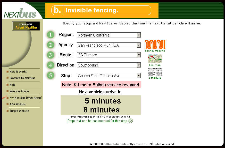
San Francisco example: nextbus (http://www.nextbus.com)
AT&T Find Friends (http://www.attwireless.com/mmode/features/findit/FindFriends/)location-based gamesbased on actual locations of playerstrackingplayed on 3G cellphones
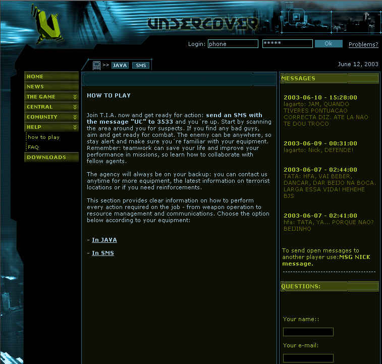
e.g. Undercover (http://www.ydreams.com)a virus that turns players into terrorists
safe havens (e.g. McDonald's)
a community website (http://www.playundercover.com)
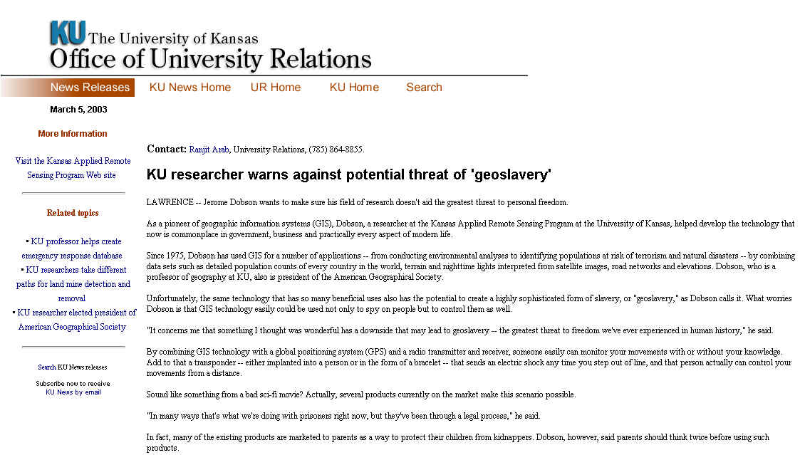
surveillance, invisible fencespets, children, probationDobson's geoslavery(http://www.ur.ku.edu/News/03N/MarchNews/March5/dobson.html)
VR: replacement of the world with a digital copy
Digital EarthAR: augmenting the senses with informationview of the world constrained by the contents of the database
uncertaintyVermeer's GeographerRoger Downs, 1997. The geographic eye: seeing through GIS. Transactions in GIS 2(2): 111-121
information about the area local to the userAR and LBSinformation beyond the reach of the senses
pastinformation to augment or replace impaired sensesfuture
round the corner
vision with sound
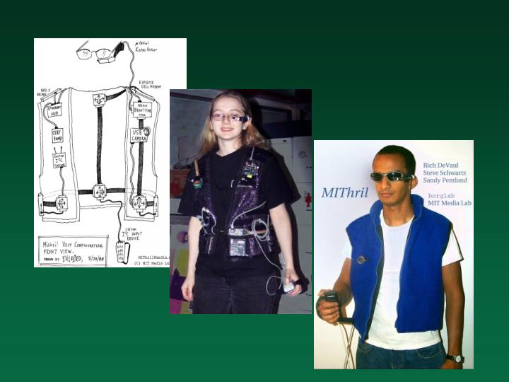
AR systems need to know where they areand the exact parameters of the sensesdevices for ARdirection of viewdisplay optionsorientation of the head
depending on the mode of HCI
cellphone, PDA, laptopwith output device on glasseshead-mounted display
Human-computer interface issues
map displays on small screensInfrastructure designmultiple representationssoundannotation
ambient light
for visual impairmentpoint-and-clickto avoid distraction
as input
access to distributed databasesProgressive knowledge constructionmiddleware, wrappers
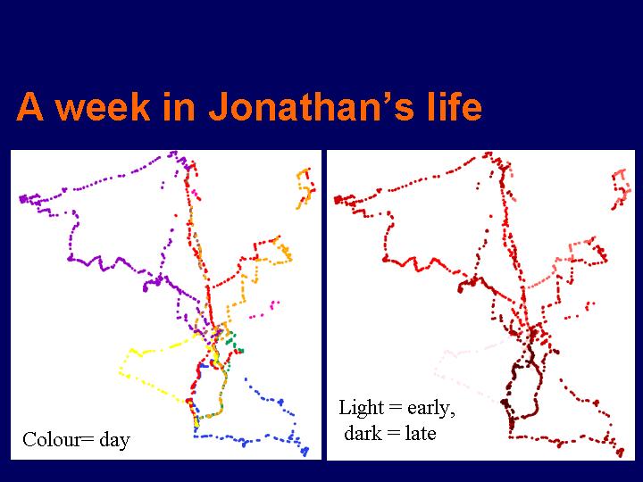
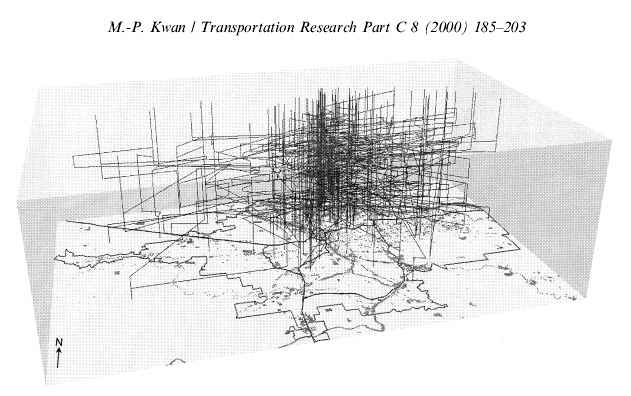
adaptive and progressive samplingResearch on tracking datametrics of completeness
dense tracking data - DTDResearch on new types of behaviorrelative and absolute1 hz or betterparsing tracks and inferring activities
a null hypothesis for tracks
visualization of tracks
how is human behavior modified by LBS?flocking and swarming
the smart mobthe value of locationHoward Reingold, 2002. Smart Mobs: The Next Social Revolution. Perseus PublishingEuropean research projectscurrently retail locations depend on visibilityin an LBS world a retailer need not be on a corner or main street to be visible