LECTURE 8: LOCATOR SERVICES, GAZETTEERS
The atom of geographic information
<location, time, attribute>How to reference a location on the Earth's surface?
to communicate, we need standard ways of dealing with all threetime
Gregorian calendarattribute
ZMTdepends on applicationlocation
temperature scales
vegetation classifications
highway classificationsmany ways of referencinghow to specify the locations of a polygon's points?
34 deg 24 min 42.7 seconds North, 119 deg 52 min 14.4 sec West
909 West Campus Lane, Goleta, CA 93117, USA
3811560N, 236150E, Zone 11, Northern Hemisphere
NE 1/4, Section 12, Township 23 Range 5 of the Second Principal Meridian
National Grid reference 11SKU36151156
Mike Goodchild's house
uniquely, so there is no confusionThe act of assigning locations to things
in a way that others can understand
with sufficient accuracy for the applicationmany methods
can they be converted?
are they interoperable?
georeferencingRequirements of a georeferencing system
geocoding
geolocatingwithin the geographic frame of reference
other frames of reference?
uniquenessA locator serviceone code per locationshared meaning
every location gets its own codeover what domain?
the entire globeover a limited domain
universal systems
latitude/longitudee.g. unique in the U.S.same geocode repeats in different places
e.g. unique to a UTM zone
e.g. unique to my farmplacenames repeat7-digit phone number repeats in every area code
10-digit phone number unique in the U.S., Canada, parts of the Caribbean
11-digit phone number (add 1) unique in the worldUTM coordinate repeats 120 times
at least 18 states have a city of Springfield"an old sycamore tree" is not unique
note the indefinite article
"the old sycamore tree" may be unique to a property
sender and receiver must both understandpersistent through time
latitude/longitude is universally understoodso is mailing address
spatial resolutionlatitude/longitude since the 1890s
but datum varies
area codes often change
ZIPs sometimes do
how big is the area covered by a single georeference?metric georeferencesRhode Island pins location down to 3000 sq kmarea or linear measure?
California only to 410,000 sq kma square of 3000 sq km is about 55 km across
a square of 410,000 sq km is about 650 km across
we tend to work with bothmeasure position with respect to fixed points
can be used to measure distances between pointsordered allocationcoordinates
e.g. Salt Lake City street addresses800 ft per block, 8 ft per address
if you live at 450 on N 1300 W St your house will be almost exactly 10400 ft W and 3600 ft N of Main and S Temple
e.g. New York avenues
a method for finding location on the Earth's surface
Locations identified by name
likely the first type of georeferencelittering the surface of the Earth
Placename authorities
state, national boardsRelative names
official authorizationBoard on Geographic Names
Geographic Names Information System
Alexandria Digital Library Gazetteer
www.geonames.org
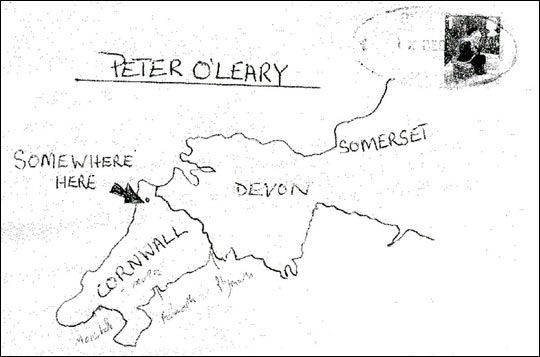
e.g. 5 miles west of Greenfield, CAProblems with placenames
e.g. between Salinas and Greenfieldthe museum collection problem
collected 1 mile north of Cachuma Saddlemetes and bounds property descriptionfrom the big maple tree, 100 ft in a southerly direction to the crossing of the creek
variable spatial resolutionThe gazetteere.g. Asialost or change through time
e.g. Eiffel Towerwhere was Camelot?only locally defined
where was Saigon?
placenames of medieval Chinathe Rivieranot officially recognized
downtown
the tricountiesthe Midwestfuzzy or crispthe Atlantic Oceancontext-specificLAalphabetsif you live in New York
if you live in RiversideChinese placenames
diacritical marks
an index linking placenames (and domains) to coordinates
intersectionthe vague world of human languagegazetteer service
the precise world of GISmost people don't know their coordinates
a service that replaces placenames with coordinatesgazetteera relation linking placenames to coordinateswith feature extent
who's asking?
point-of-interest database
businesses, prominent features
geoparsing
mining text for placenamesWiki efforts to build gazetteers
microformat
adding coded tags to pages
e.g. Wikipedia entries
e.g. photos in flickr
Devised for specific purposes
used for many other purposesPostal codes
ZIP - 93117-4338unique in US
spatial resolution <1 block
changes made frequently
UK postcode - SE3R 1KWCanadian postcode - N6G 1R1
widely known and accessiblemailing listsArea codes
widely used for marketing, analysisuseful as geocodes?
905
Lat/long is cumbersome
DMS
left-most digits redundant for most people
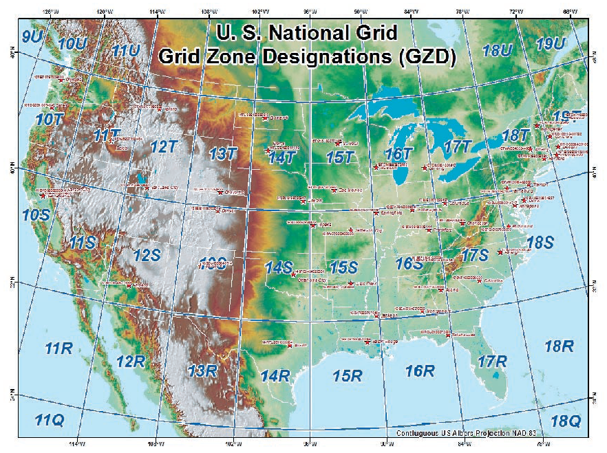
The National Grid
an effort to establish a single easily used grid for the US
a single string of characters
18SUJ20 - locates a point with a precision of 10 km
18SUJ2306 - locates a point with a precision of 1 km
18SUJ234064 - locates a point with a precision of 100 meters
18SUJ23480647 - locates a point with a precision of 10 meters
18SUJ2348306479 - locates a point with a precision of 1 meterlength determines spatial resolution
based on UTM
2 digit zone number
1 letter 8-degree latitude range
1 letter 100km N-S
1 letter 100km E-W
decimal digits northing
decimal digits easting
e.g. my house 34 24 42.7 N, 119 52 14.4 W
11SKU3614611561
UTM Zone 11 236146m East, 3811561m North
The GO2 grid
general principles, details may vary
city-centerede.g. Santa Barbara Courthousestereographic projection also centered
e.g. LA Courthouse
e.g. Washington Monument"stake hammered into the ground"
100 km square centered
most city residents and visitors live and work in this areafirst level - 10 km resolutionnumber columns 0 thru 9second level - 1 km resolution
number rows 0 thru 9pair of digits gives location to 10km resolution
third level - 100 m resolution
fourth level - 10 m resolutioninterleave digits, separate by periods
e.g. 34.71.84.06a grid that is Internet-readyis 37800 m east, 41460 m northcity center is at 55.55.55.55
rounded to nearest 10 mlooks like an IP address
combine with city IDe.g. SBA.34.71.84.06
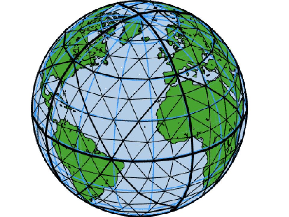
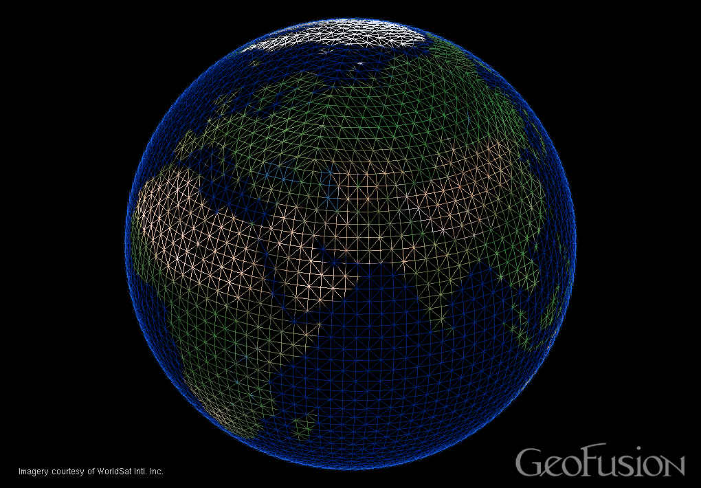
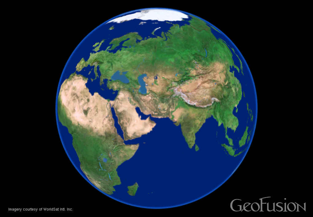
How to reference the entire globe
without projection distortions
Perspective Orthographic projection
without interruption at the poles and dateline
with smooth zoom to local scales
virtual globes
Implementations
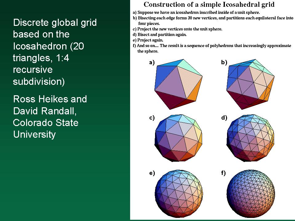
Dutton's Quaternary Triangular Mesh (QTM)
Level 0 - 0 thru 7
Levels 1... - 0 thru 3e.g. 6310132
references about 1/(8x4x4x4x4x4x4) of the Earth's surface
or about 15,300 sq kmlevel 13 is 1 km resolution
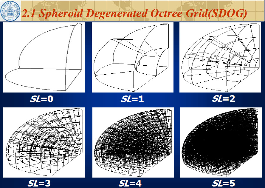
Colorado State's Icosahedron grid