GEOGRAPHY 176B: TECHNICAL ISSUES IN GIS
LECTURE 7: THE NATURE OF GEOGRAPHIC DATA
What do we expect geographic data to look like?
is it just any data?
or is spatial special?
how to design systems to handle a type of data
with certain specific properties
how to address the fundamental problem
that in principle geographic data is infinitely voluminous
are there laws of the geographic world?
can they be used to improve VGI quality
can we triage geographic facts
to identify the ones that are more likely to be true?
Tobler's First Law of Geography
dates from 1970
what to do about missing data?
how to fill the gaps?
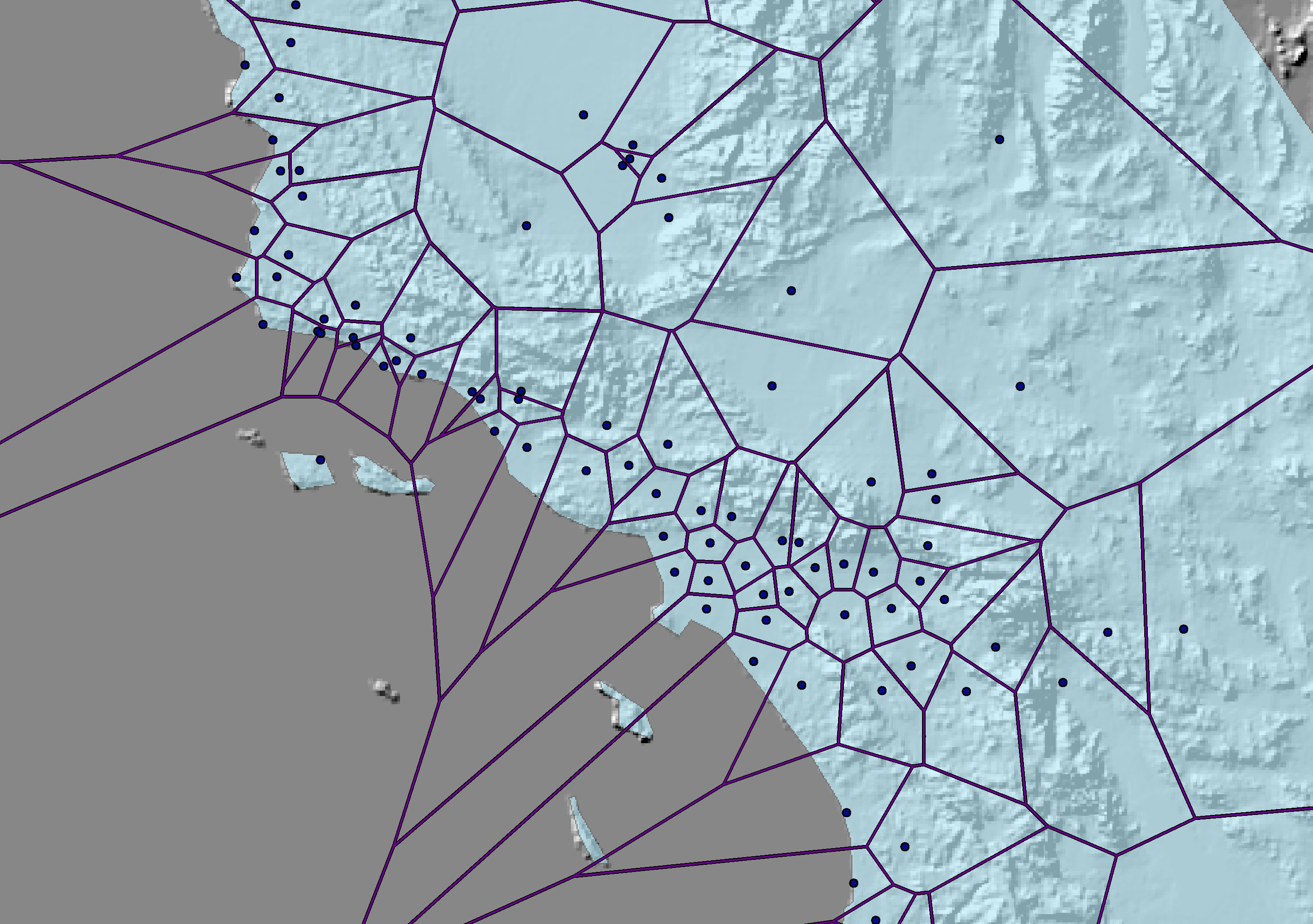
Thiessen faced the same problem
how to estimate rainfall in places where no measurements had been made
copy the measurement at the nearest raingauge
"all things are related, but nearby things are more related than distant things"
nearby things are more similar than distant things
phenomena vary slowly over the Earth's surface
compare time series
today's Dow index is not sampled independently from all possible values
it represents an incremental shift from yesterday's
the best forecast of today's temperature may be yesterday's
the best forecast of your house's value may be your neighbor's
what does this imply?
we can get away with sampling fields
e.g. at weather stations
filling in the gaps using estimation procedures
without Tobler's First Law there would be no spatial interpolation
we can create regions out of the Earth's surface
and expect little variation within them
we can create polygon datasets
without Tobler's First Law there would be no polygons
we can see if purported facts are consistent with their surroundings
horizontal context
or hot spots, cold spots
is it true?
note scale issues
imagine a world without it
constantly falling off a cliff
a salt and pepper world
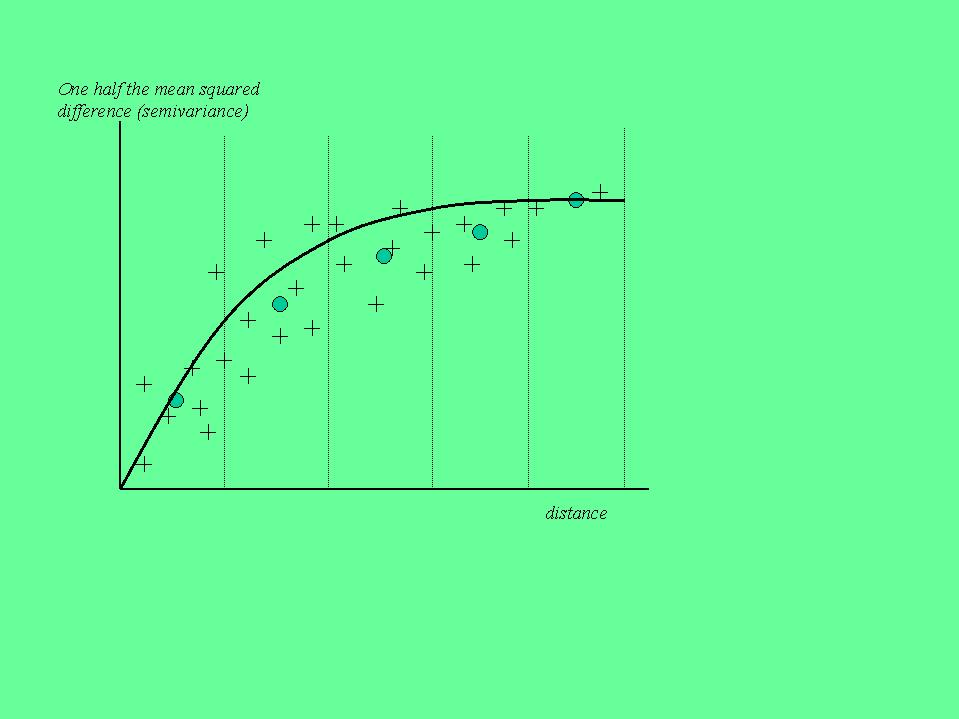
why does it happen?
how to measure the effect?
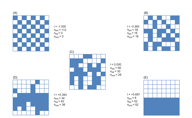
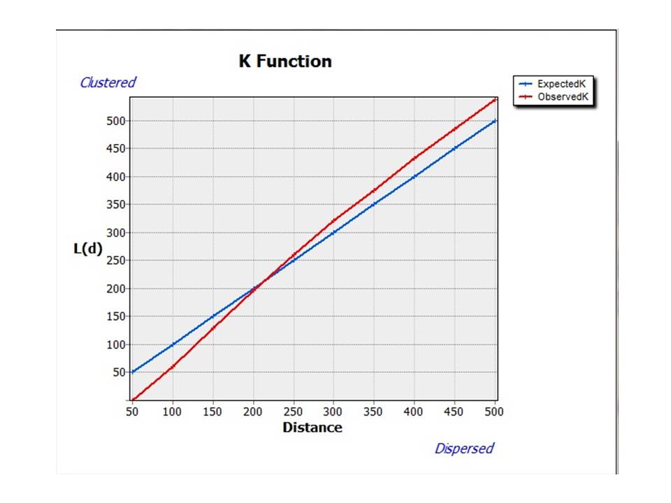
spatial dependence
spatial autocorrelation
two types of measures
Moran (and Geary) indices
exceptions
negative spatial autocorrelation
anomalies, outliers
anomalous Milwaukee census tract
what about the first part of the statement?
"all things are related"
horizontal context
the tendency for nearby things to be similar
vertical context
the tendency for things at the same location to be related
is it possible for two maps of the same area
showing different phenomena
to be completely unrelated?
or can you always tell they are of the same area
however different their content?
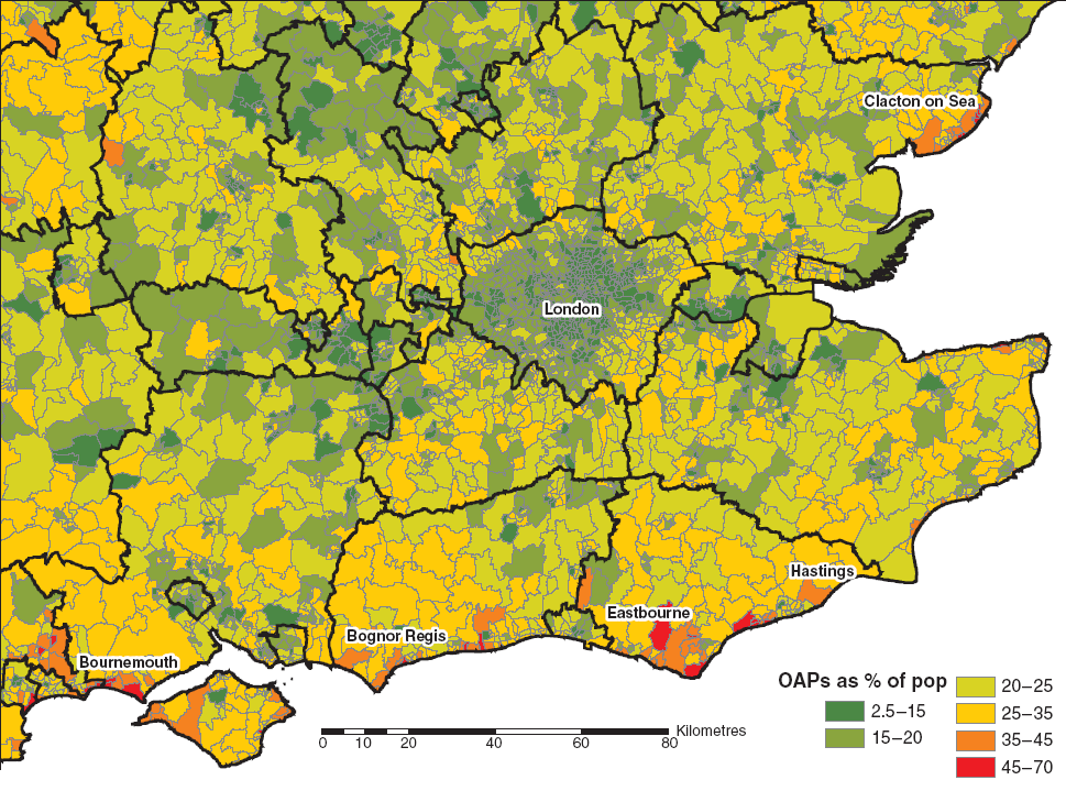
conditions vary over the Earth's surface
statistical non-stationarity
climate
social conditions
laws of physical sciences remain constant
virtually everything else changes
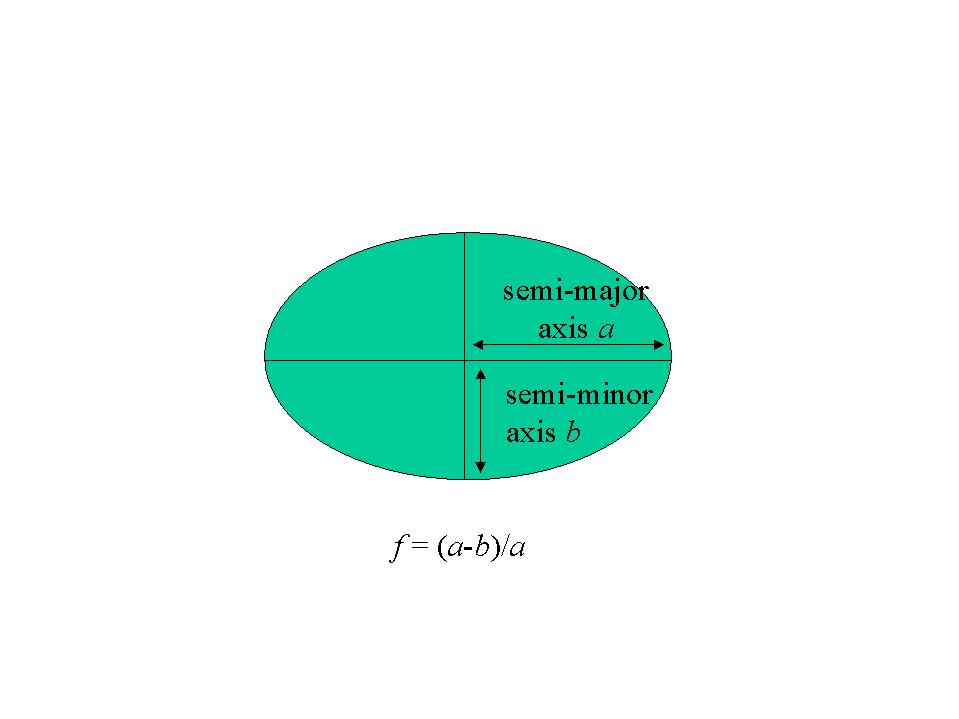
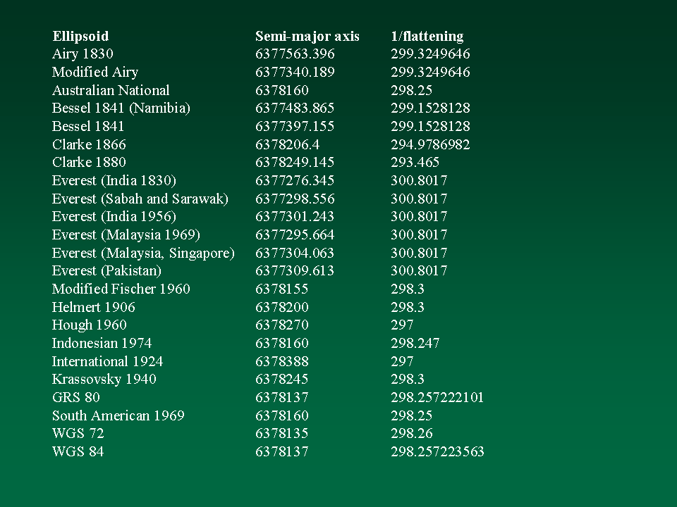
best fit ellipsoid changes
a global standard won't fit as well as a local one
some local ellipsoid standards
NAD83/WGS84 vs NAD27
classification systems change
every country in Europe
every state in the US
results of analysis of a limited area will change when the boundaries shift
how to generalize from a limited area?
is there an average place?
place-based analysis
results are unique to the study area
compare %black with median value by county in different states
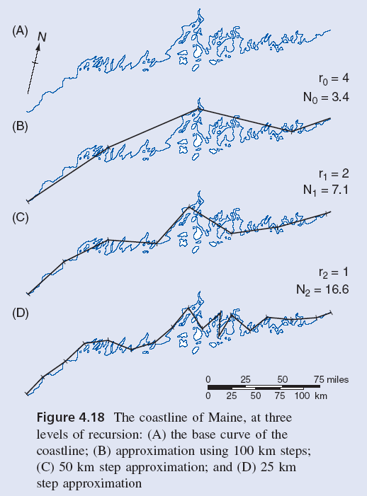
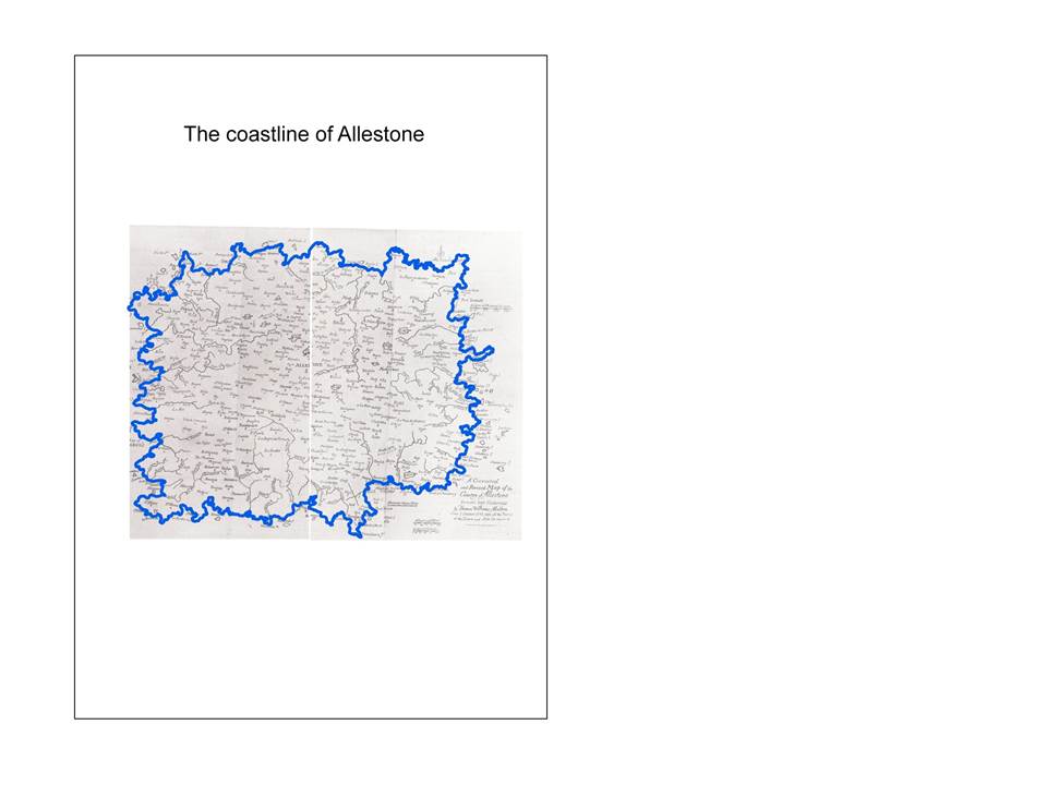
what happens to features as scale changes?
rivers, roads, coastlines get longer
polylines cut fewer corners
surface area increases
the Earth's surface reveals more detail
the closer you look the more you see
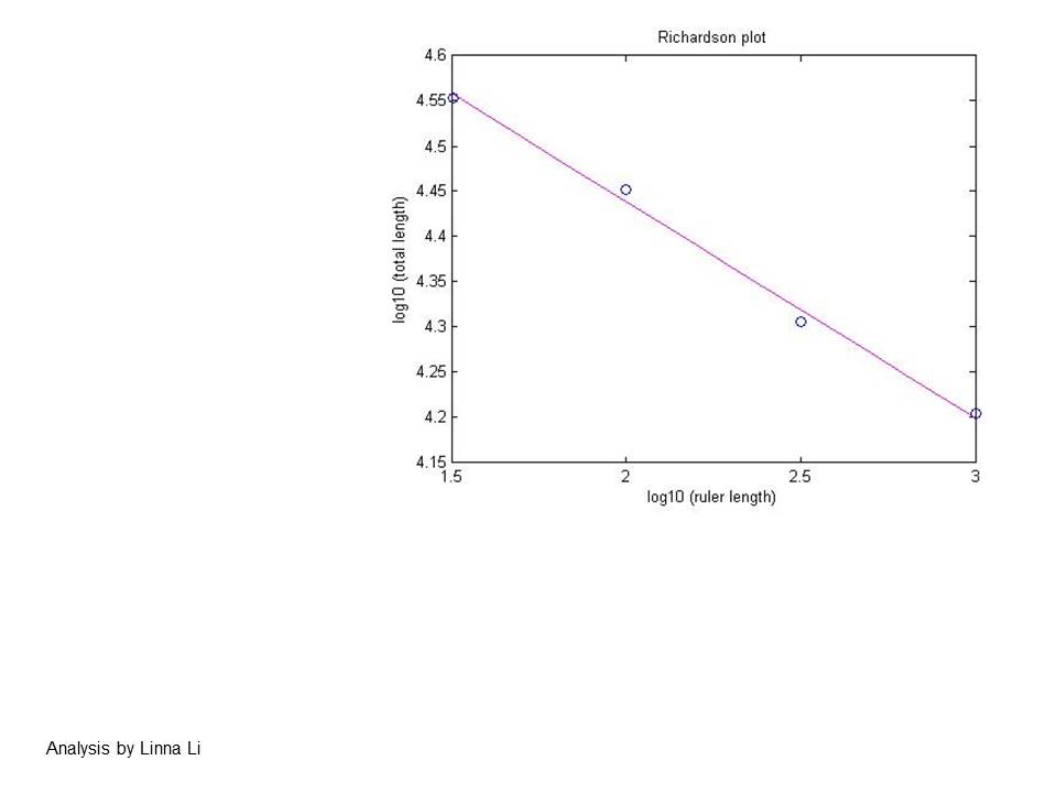
The Statistics of Deadly Quarrels
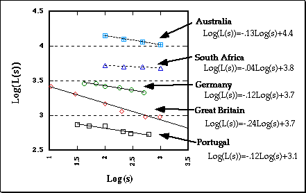
features reveal more detail at predictable rates
the theory of fractals
"geographical monsters"
lines that don't behave as lines
space-filling curves
fractional dimension
somewhere between 1 and 2
surfaces somewhere between 2 and 3
practical significance?
length of lines always underestimated
by an amount depending on scale
surface area always underestimated
Any more principles or laws?
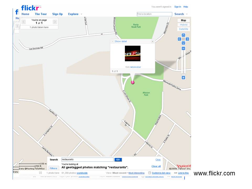
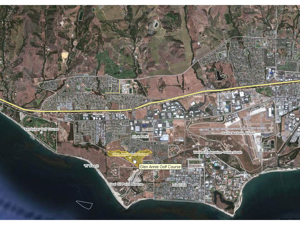
How to improve VGI quality?
Wikimapia and Glen Annie Golf Course