LECTURE 1
B. WHY ARE REPRESENTATIONS NEEDED?
What kinds of jobs exist in GIS?
1. System developersWhat do you need to know to be a success as (3) System user?high level of technical skills2. System maintainers
programmers in C++, C#, Java
order 10,000 peoplemoderate technical skills3. System users
programmers in UML, Visio, CASE, Visual Basic, Python, PERL, Jscript
order 30,000 peoplemodest technical skills
know how to use the tools
familiar with the technical issuescritical spatial thinkers
Critical spatial thinking:
4. General publicwhat goes on in the mind of an experienced GIS user while using GIS
a set of principles that are independent of the technology
example: a Mercator projection in ArcMap
what does scale mean?
how is distance measured?
know the application domain
work for governments, corporations, universitiesorder 100,000 peopleminimal skills
know how to use some tools
order 1,000,000 peopleperhaps 100,000,000 with some exposure
not critical spatial thinkers
the basic principlesWhat about hands-on practical training?still there when the software changeshow to be a demanding skepticdemand better documentationwhat GIS means
accurate data that reflect the real world
reliable and accurate results
fixes for bugswhat the data mean in the real world
what operations mean
software changes often (every 2 years)
hands-on experiencereinforces basic principles
encourages you to be a demanding skeptic
encourages thinking about what GIS means
Geographic information science
the science behind the systems
what a demanding and skeptical user thinks about
the fundamental issues raised by GIS
fundamental spatial conceptslocation, distance, direction, scale, uncertainty, dynamics, ...
the nature of the geographic world
How do we know what we know?
The human senses
sight
visible spectrum
line of sight
horizon at ~10km
visibility 100km
sound
audible spectrum 50Hz to 15KHz
range 100m
taste
touch
smell
Everything else we know about the world we know through communication
text
speech
maps
photographs
radio, TV
Internet
databases
Knowledge of the surface of the Earth
500,000,000 sq km
on average 100 sq m is sensed directly at any time
p=100/500,000,000,000,000=.0000000000002
extend that through migration, travel by road
5 billion years
we live through 70
p=70/5,000,000,000=.000000014
we know almost nothing about the surface of the Earth via our senses
We rely on communicated information to:
decide where to go as tourists, shoppers
run large corporations
manage agriculture, forestry
choose where to live
All such information must use a representation
what is communicated is a representation of the real thing
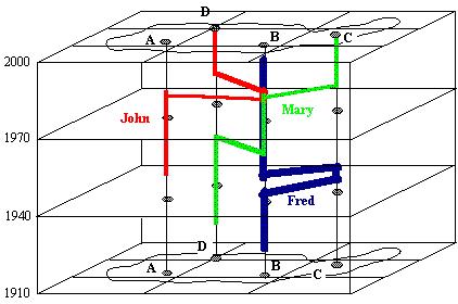
a representation of three life histories
locations in time and space reduced to a few straight lines
what would more detail show?
representations always simplify the real worldthe real world is infinitely complex
representations reduce information to manageable volume
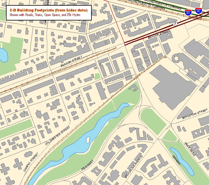
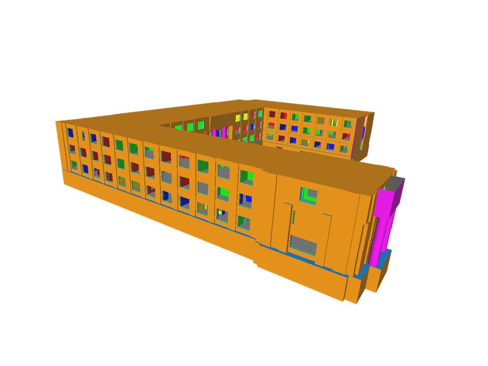
Example: representations of buildings
2.5 D: elevation is a function of 2D location
elevation can have only one value at any 2D location
no overhangs, tunnels, bridges, internal building structure
textured representation of Shanghai
Google Earth 3D Building Warehouse
Representations occur:
in the human mind, in memory and reasoning
in speech
in written text
in photographs
in digital databases
in GIS
We must have them:
to communicate
to go beyond the space-time limits of our senses
to deal with an infinitely complex world
Much human communication is now digital
sent through a "pipe" that can transmit only 0s and 1s
stored on devices that can store only 0s and 1s
processed as 0s and 1s text in email, word processors
voice in telephone
music on CD
DVD, digital TV
FAX
When two humans communicate at a distance, chances are the content is expressed at some point in digital form
Digital
from "digit" meaning finger
a character in a counting system
how many symbols?
0 thru 9
0 and 1
the binary system
to all intents and purposes "digital"="binary"
how to express knowledge exclusively in 0s and 1s?
how to describe what we know about the world in 0s and 1s?
the fundamental question of data modeling for GIS
Digital vs Analog
analog: information expressed by scaling physical quantities
good for quantitative information
a paper map is analog
the world is scaled to a miniature representation
representative fraction: the ratio of distance in the model to distance in reality
e.g. 1:24,000
digital: information expressed by symbols
there must be a coding scheme to express the representation in symbols
sender and receiver must agree on the scheme
what does scale mean for digital data?
there are no distances to measure in the representation
Why binary?
same for all kinds of information
same technology whatever the content
"a bag of bits"
massive economies of scale
miniaturization
Some digital coding schemes
text
one code per character
A = 65, B = 66, etc.
26 letters plus common symbols
originally 128, extended to 256
8 binary digits (one byte) per character
images
JPEG, TIFF, GIF, BMP, ...
music
MIDI, MP3
FAX
CCITT
maps, geographic information
GIS data models and structures
Digital coding schemes important in GIS
ASCII
eight bits per character
names, text
annotation
integer
3 bits per decimal digit
n bits give 2ˆn options
it takes about 3 times as many binary digits to express a number
16 or 32 bits per whole number (short, long integer)
-32767 to +32767
-2 billion to +2 billion
float (single precision)
1 sign bit
8 exponent bits (-38 to +38)
23 mantissa bits (8 significant digits)
double precision
1 sign bit
11 exponent bits (-308 to +308)
52 mantissa bits (17 significant digits)
what might you need to know to 17 significant digits?
BLOB
binary large object
e.g. image
What if you received this reply message:
000001111101110000000000000011000000000000010101
what would be the question?
What if you had to send a message to outer space?
Communication of information via a channel
How efficient is the channel of communication?
is there information that can't be expressed?
text omits gesture, pronunciation, voice inflection
can "duh" be written in text?
what are the limits of a GIS as a communication channel?
what information about a place can't be expressed in GIS?
what if the sender and receiver can't understand each other?
different language
different alphabet
different GIS
Interoperability: the ability of two systems to exchange data
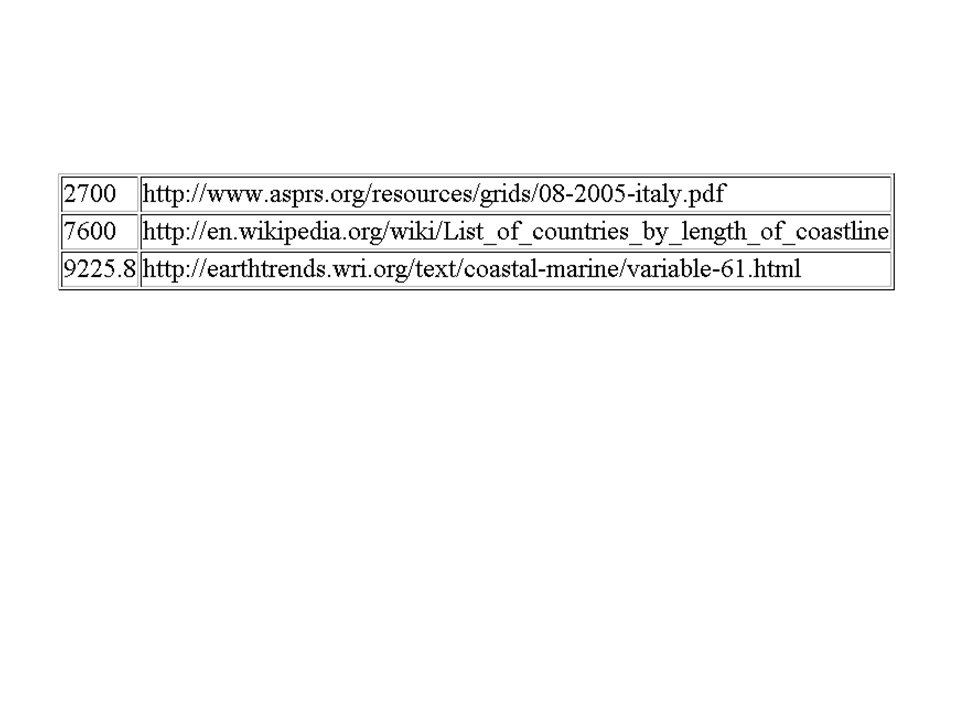