Lecture 3: Geocoding Spatial Data
Models of the World
World model used for GIS work includes the sphere and the geoid.
Model allows selction of the map geodetic datum.
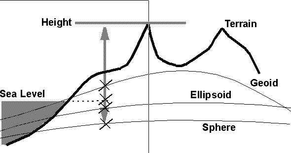
- Most often this reflects the local coordinate system in use.
- Common geoids for North America are: NAD27, NAD83 and WGS84.
- Errors of datum can be hundreds of meters vertically and horizontally.
- Translations are possible using several alternative special purpose progams or a GIS.
- Map projections can use sphere, ellipsoid or the geoid.
- Simple basis os the "developable form" (plane, cylinder, cone)
- Scale is twofold: (1) Scale multiplier and (2) local scale.
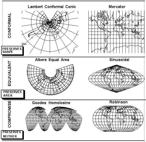
- No flat map can be both conformal and equivalent
 .
.
- Map projections always sacrifice something, such as continuity, one-to-one
etc.
- Can be interrupted in many places.
- Can be equatorial, transverse or oblique.
- Can be tangential or secant. Secant "cuts" the earth along a line.
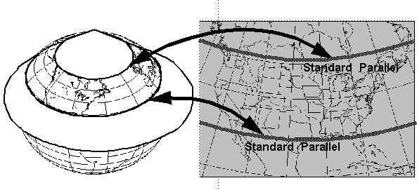
- Very common US map is lambert conformal conic, secant at 45 and 30 degrees
North.
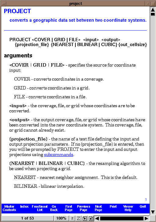
- GIS packages can convert between map projections. e.g. Tralaine and Atlas*GIS
- In Arc/Info use the PROJECT command
- Arc: project
- Usage: PROJECT <COVER | GRID | FILE> <input> <output> {projection_file}
- {NEAREST | BILINEAR | CUBIC} {out_cellsize}
- Most basic coordinate system is the geographic.
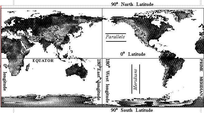
- Most GIS systems store map reference data in geographic coordinates in decimal
degrees.
- Data are projected as needed.
- Also common to store GIS files in single coordinate system.
- Other systems in use;
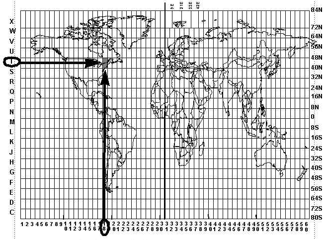
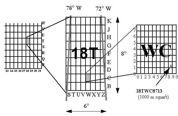
- UTM
- World Divided into 60 zones, six degrees wide
- Civilian version, 84N to 80S.
- Strip map of earth drawn on Transverse Mercator, centered on central meridian.
- False origin for easting, central medridian placed at 500,000mE
- Origins for northing at S. Pole and Equator.
- Zones are adjusted (made secant) by scaling along central meridian
- System printed on many maps, including USGS
- UPS
- Military Grid
- State Plane
- World Geographic Reference System
- Landsat WRS (Path and Row)
- National Grid Systems e.g. UK.
Land Partitioning Systems
Cadastral Systems
Projection Distortion
- Has a spatial distribution.
- Can be scale, direction or area distortion.
- Often visually shown by Tissot's indicatrix.
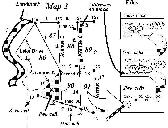
- Conversion of a street address to a georeference in a standard coordinate
system.
- Try your own house at the ETAK MapsOnUs site
- System works by using TIGER features and topology.
-
K. Clarke Last Update 1/13/97